...there existed the medieval principalities of "Duklja" and "Raška" in the Western Balkans. These two historical regions were located on the border between the Greek East and the Latin West, in a contact zone between the Catholic and Orthodox Churches.
Beyond East and West
FROM THE 11th TO THE 14th CENTURY...
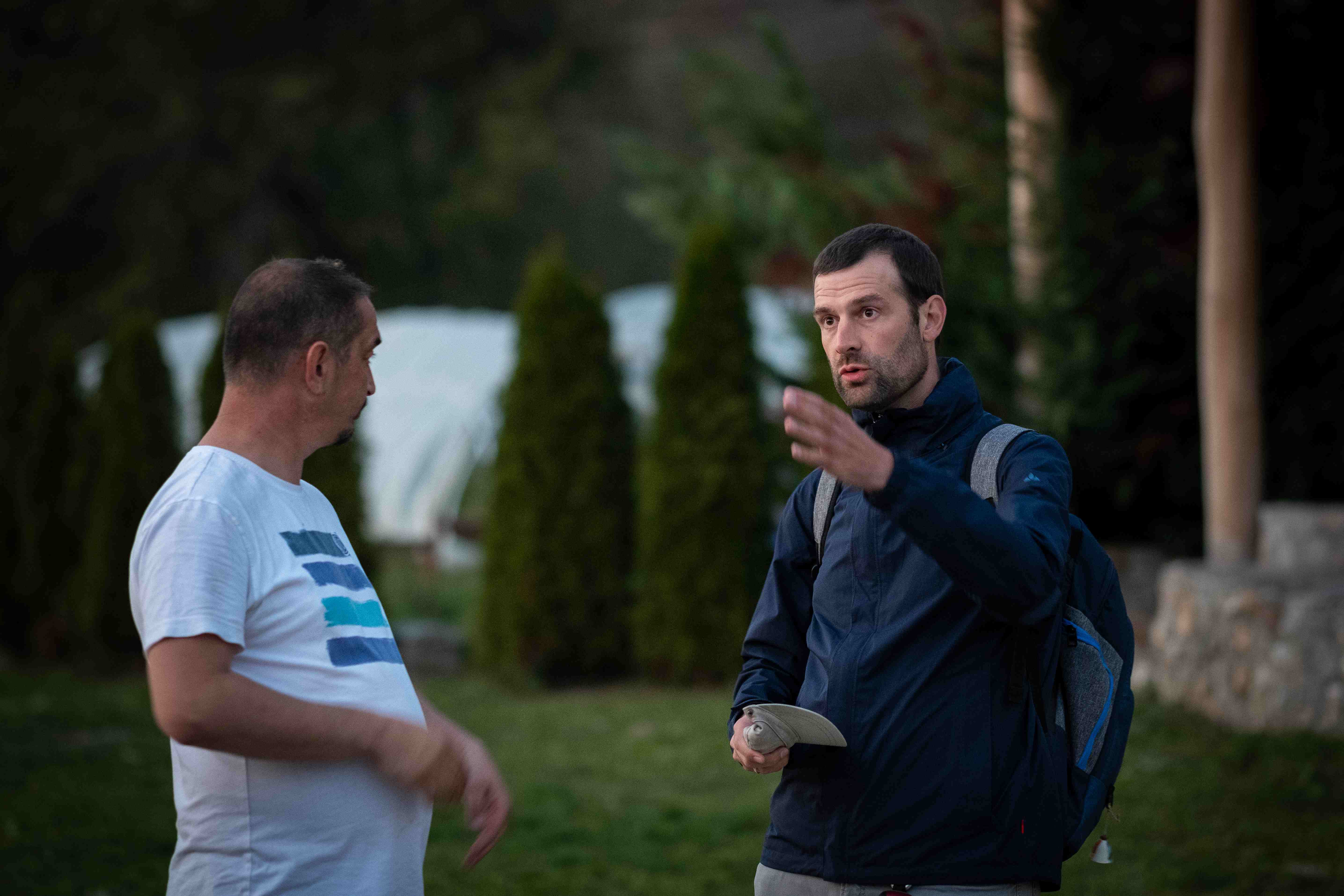
HISTORIAN MIHAILO POPOVIĆ
...talks with the priest named Siniša in the Montenegrin village Zaton. The priest tells him how he built the church from scratch. He found the ground plan when he became a priest in the village. Stone by stone he rebuilt the church, which today is the center of Orthodox religious life in the region.
Popović analyses churches and monasteries from the Middle Ages and classifies them from a religious, chronological and spatial perspective in order to provide an overview of the patterns of faith. In his research, he traces, whether a church was consecrated Orthodox or Catholic to find out more about the supposed conflict between the Greek East and the Latin West in the Middle Ages. After all, these were determining factors in the lives of the local population.
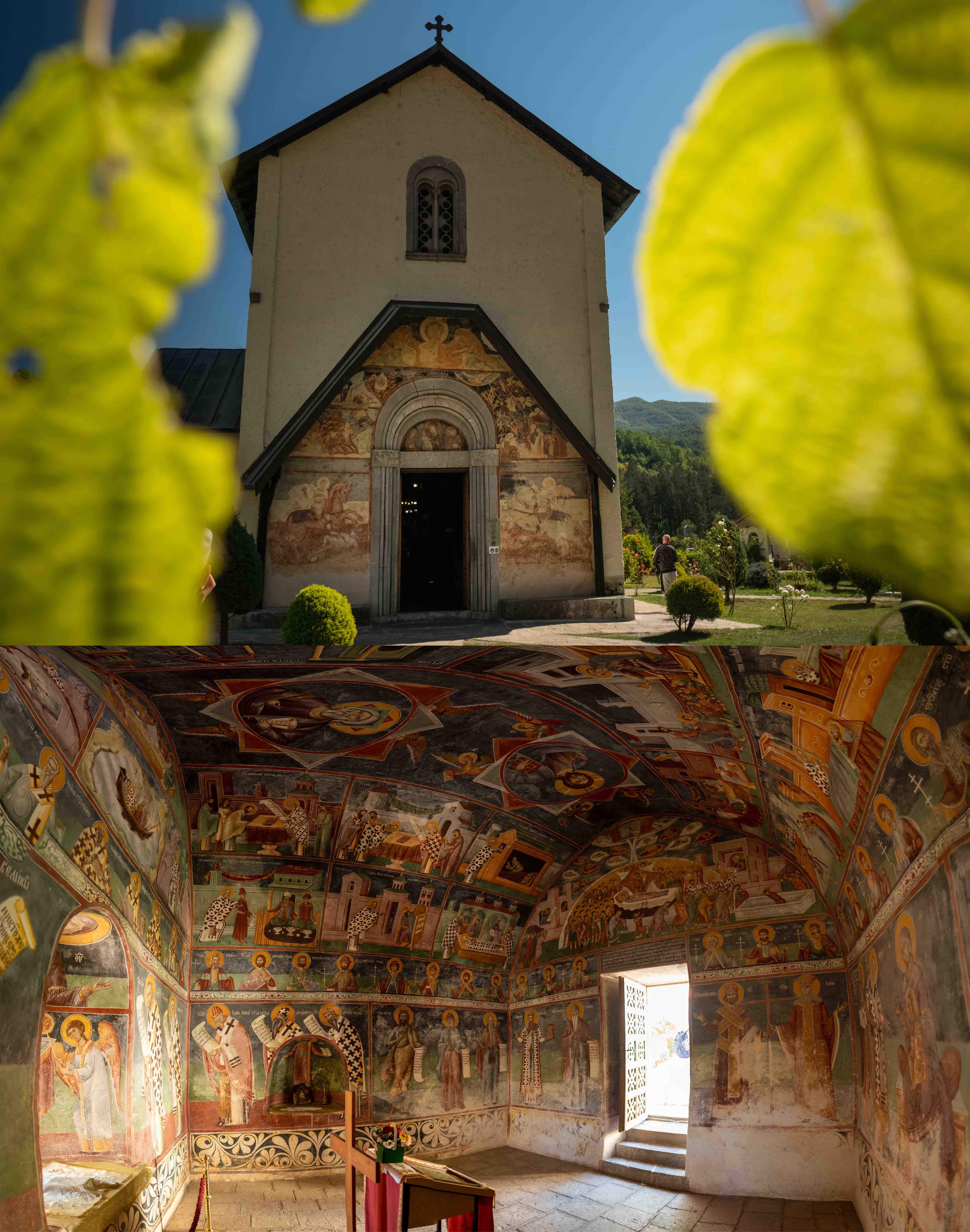
The church of Sveti Jovan Krstitelj in Zaton, in present-day Montenegro, originally dates from the Early Middle Ages and was consecrated Orthodox, indicating the influence of the Eastern great power of Byzantium in this region.
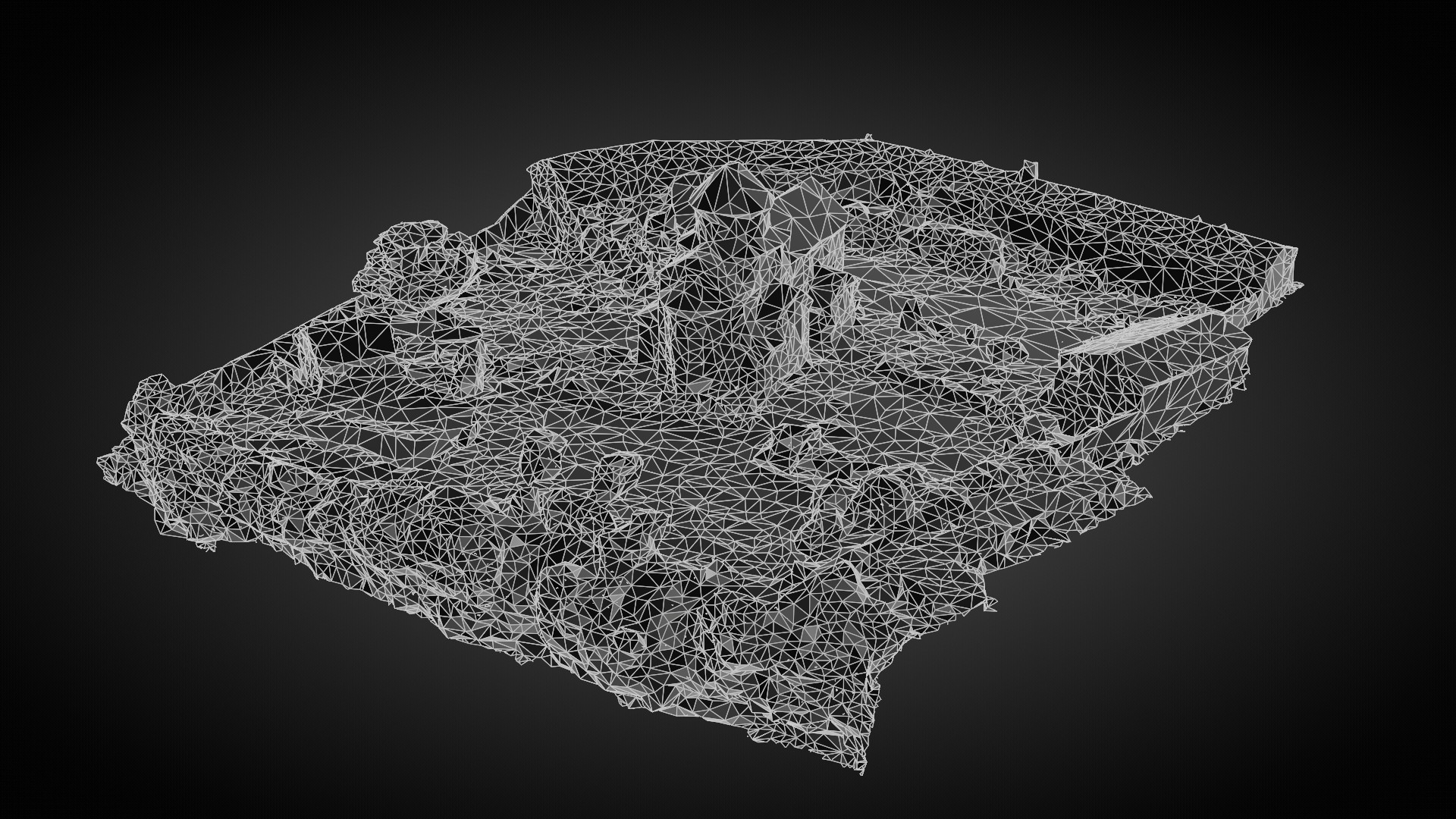
To understand the religious landscape of the Middle Ages, Popović had to make extensive field trips. He visited, photographed and described churches and monasteries from different periods, from the 6th to the 15th century, and spoke with the priests to explore how they fit into the landscape of the time.
Sacred LANDSCAPE
The European Landscape Convention defines landscape as an area perceived by humans, which consists of the interaction of natural and/or human factors. Thus, a landscape does not only consist of the material, natural and anthropogenic things, but only becomes a landscape through the perception and interaction of people. Accordingly, a Sacred Landscape is a part of the landscape formed by sacred buildings and sacred places, as well as religious perception and interactions.
"THE SPACE IS A STAGE OF TIME"
For the historian Mihailo Popović space connects the development of the world from the topography of natural conditions, through political and religious changes and structures, to the fates of the people. Therefore, the geographic location of churches, monasteries, and sacred artifacts is an important indication of the spatial structure of the church's sphere of influence.
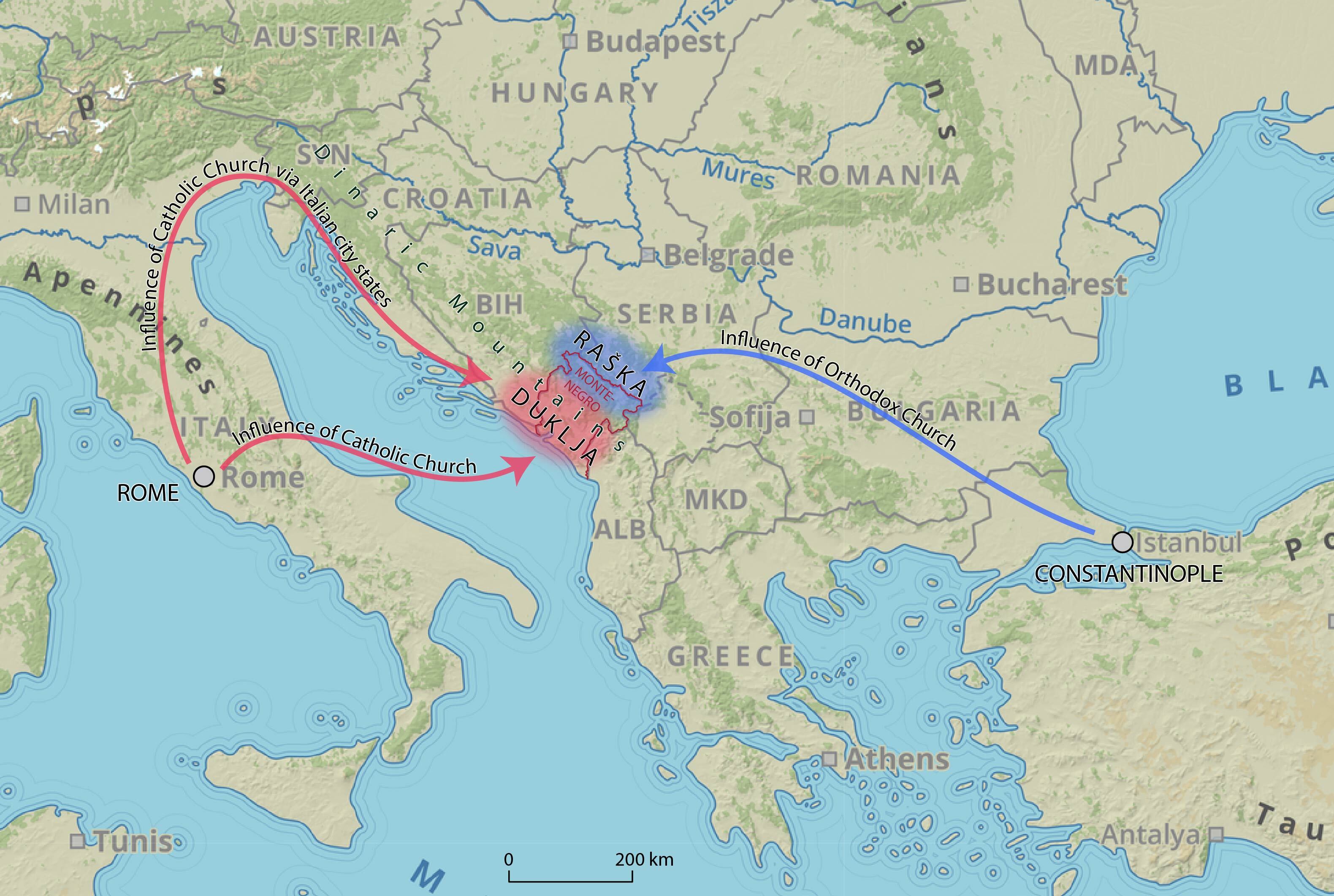
The principalities of Duklja and Raška were located in the former border area between the Western and Eastern Roman Empires. However, after the disintegration of the Western Roman Empire, an ecclesiastical influence remained from the West through Rome and from the East through Constantinople (today Istanbul). Consequently, the hinterland, Raška, and the North-Eastern regions of Duklja were Orthodox, while the coast was under Catholic influence. Even though the borders between the two principalities were not clearly defined, the Dinaric Mountains separated the two religious zones.
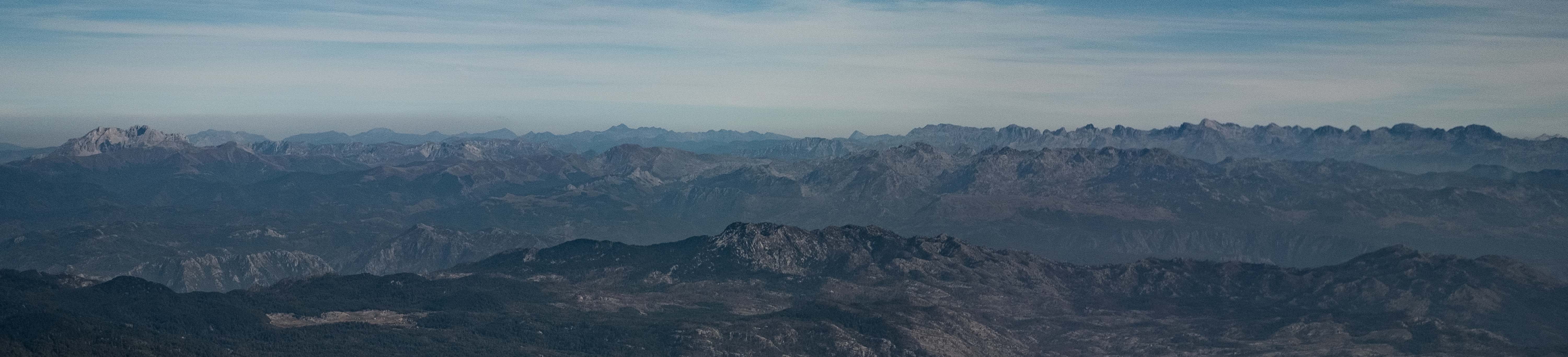
THE DINARIC MOUNTAINS
The hinterland and the coast of almost the entire Balkans are separated by the Dinaric Mountains. In the Middle Ages, the mountains constituted a natural barrier, as there were few connecting routes to the Mediterranean and vice versa. It is possible that the topographical features contributed to the religious power segregation between the Orthodox influence in the hinterland and the Catholic influence on the coast.
MONASTERY MORAČA
The Monastery Morača is located exactly at the key location between the hinterland and the coastal region in Montenegro. Popović, according to his latest research, assumes that this monastery played an essential role in the exchange of Orthodoxy with Catholicism in this region, although it was always Orthodox oriented.
The Morača Monastery was founded in the middle of the 13th century by Stefan, the grandson of the first Serbian Nemanjid ruler Stefan Nemanja. The entrance portal of the monastery church shows strong Romanesque influences. Its fresco painting was destroyed in the course of history. The location of the monastery suggests that it was a link between the coast and the hinterland in the then historical region of Duklja (later called Zeta). The Chapel of St. Nicholas (Sveti Nikola) next to the monastery church, however, preserves beautiful paintings depicting the life of the saint in detailed scenes. Although they date from the 17th century, they are similar in color and style to the 14th century originals.
All churches and monasteries in the region have a religious attribution, a geographical location and certain architectural features, which Popović wants to identify and document with the help of the art historian Branka Vranešević and the geographers Markus Breier and Lukas Neugebauer.
By bringing together the research results of all three disciplines (history, art history and geography), an overall picture of the ecclesiastical landscape of the time should become visible. The science project is thus about the distribution of churches and monasteries in space and time.
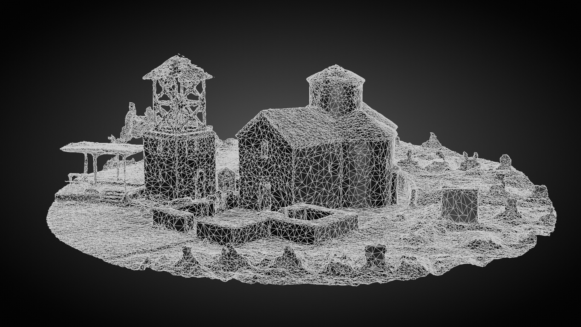
THE CITY DOCLEA
The Ancient Roman city of Doclea gave its name to the region of the Principality of Duklja.
After the conquest of the territories in today's Montenegro by the Roman Empire, a new structure of settlements and transport routes was created. The Roman city of Doclea which was discovered not far to the North of today's Montenegrin capital Podgorica, has a large number of monuments from the 1st to the 4th century. With the invasion of the Slavs, the city fell into disrepair, but gave its name to the entire region of Duklja. In the Early Middle Ages (about the 9th century) the town was possibly partially repopulated. This is evidenced by Basilica B, which was renovated at that time. This Roman town became a legendary place, whose name survived the centuries.
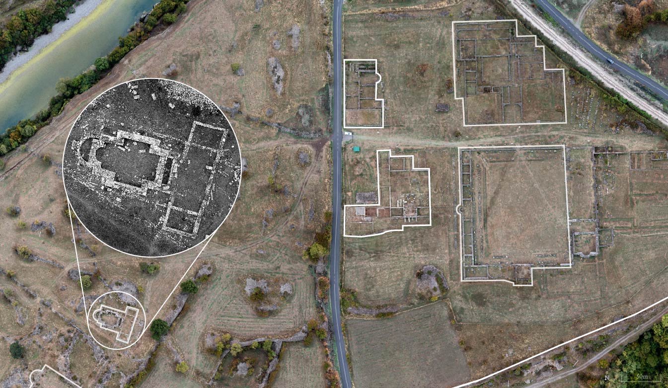
Basilica A
Basilica B
Ancient
Thermae
Thermae
Roman
Temple
Temple
Ancient Forum
The City Wall
Click on the names for more information about the historic buildings.
THE PENINSULA OF FLOWERS
The "peninsula of flowers" (Miholjska prevlaka) is a place that has been coveted throughout history. In the midst of the vacation bungalows lie the medieval foundations of a Church of St. Archangel Michael. The church existed already in Early Christian times. After the foundation of the Serbian Orthodox Church (1219), a bishop's seat was established there. As an Orthodox church in the Middle Ages, it is an exception on the predominantly Catholic coast and shows the intertwining of the two ecclesiastical streams in Duklja and Raška.
However, in modern times the complex became Catholic. During the communist rule after 1945, the peninsula was built up with vacation homes of high-ranking officers, and the monastery was uninhabited and fell into disrepair. After the fall of Communism, Orthodox monks moved back to the peninsula. They have the firm intention to rebuild the monastery church according to the medieval model.
The fact that the Church of St. Archangel Michael was built before the Schism of Christianity (1054) and later was not consistently Orthodox, makes the division of churches into the two categories "Orthodox" or "Catholic" problematic. It is not always possible to make a clear distinction between the buildings, as this depends on the period in question.
THE RUINS OF RATAC
Evidence of the blending of Orthodoxy and Catholicism in Duklja is the Church of Ratac. The ruin is prominently located on a coastal promontory of the Mediterranean Sea and is still used by the Orthodox and Catholic parishes. At a Catholic altar in the East of the ruin the Catholics celebrate, and right next to it on a wall the Orthodox service is held.
Besides the blending, this church also shows the peaceful coexistence of the two religious denominations. Already in the Middle Ages, Orthodox Serbian farmers and Catholic Venetian merchants met at the weekly market in the Bay of Kotor. There was trading, importing and exporting, so the different ways of life met and exchanged regularly. The Serbian rulers enacted laws that protected all communities, but also strengthened obedience to the ruling house.
Basically, the church-political influence from Rome and Constantinople was not present and widespread everywhere in Duklja and Raška, and precisely for this reason there was enough potential for the people and local rulers to build their own structures and not necessarily live in the supposedly religiously separated regions. In fact, there are written sources and oral traditions that testify to a certain mixing of religious confessions. For example, the French-born noblewoman Hélène d'Anjou married the Serbian King Stefan Uroš I in the 13th century and endowed both Orthodox and Catholic monasteries. Her legacy lives on in the ruins of the church of Ratac.
Sveti Ilija
The Church of St. Elijah (Sveti Ilija) is located on a picturesque rocky outcrop in the village of Dobrota in the Bay of Kotor. It is a small, one-room church with a long history. It is possible that a predecessor building stood here as early as the 10th or 11th century. The present building certainly dates back to the 15th century (ca. 1430). This church is in the tradition of the Latin church, because it is located in the immediate vicinity of the Latin (Catholic) trading town of Kotor.
Prečista Krajinska
The Monastery Church of the Mother of God Krajinska (Prečista Krajinska) is one of the most significant buildings on the South-Western shore of Lake Skadar. It was founded by the Serbian ruler Jovan Vladimir at the end of the 10th/beginning of the 11th century. After his violent death in 1016, he was buried in it. Its architectural peculiarity are the three conchs (like a three-leaf shamrock), i.e. three round, large niches, one of which housed the chancel. In the South of the Balkan Peninsula there are only few examples that resemble this church. One example is the already mentioned Church of St. John the Baptist (Sveti Jovan Krstitelj) in Zaton, in the hinterland of present-day Montenegro. Another example is the Church of St. Pantelejmon in the town of Ohrid in North Macedonia, which also dates back to the 10th/11th century.
The Monastery Church Prečista Krajinska was renewed several times (e.g. in the 14th century) and today lies in ruins. The ruins of this church show clear parallels with neighboring historical regions, such as Ohrid. This contributes to the complexity of the concept of Sacred Landscape in the Middle Ages. Not only the religious dedication, but also the building forms indicate possible connections between the coast and the hinterland and draw a map of the cross-border sacral landscapes on the Balkan Peninsula in the Middle Ages.
The churches of Svač
The ruins of the Church of the Blessed Virgin Mary in Svač are located to the North-East of the town of Ulcinj. It was a foundation of the Franciscan order. It was a Latin (Catholic) church founded by the above-mentioned Serbian Queen Jelena (Hélène d'Anjou) at the end of the 13th century. Jelena, as a Frenchwoman, was originally Catholic and married the Orthodox Serbian King Stefan Uroš I. This example shows that marital unions of ruling families contributed to the mixing of the two ecclesiastical structures in the Middle Ages and promoted peaceful coexistence between Orthodox and Catholics.
Therefore, it is not surprising that around 1300 another Catholic church was built in the immediate vicinity, dedicated to St. John the Baptist. Today it is also a ruin and was possibly built by King Stefan Milutin, the son of Queen Jelena.
THE SACRED LANDSCAPE
The result of Popović's research can be seen on this map: The spatial distribution of churches and monasteries of the Middle Ages shows a certain separation between Raška and Duklja (blue and red zones, respectively). Nevertheless, in certain areas there were mixtures of both rites. The Orthodox consecrations of certain church buildings, especially on the coast, result from the frequent advances of the Principality of Raška towards the Mediterranean, as well as from the local links between Orthodoxy and Catholicism. Popović had already expected this mixing, but now he discovered a certain "empty" zone. Exactly between the hinterland and the coastal region, no information can be found in the sources, literature or on the basis of human remains (monuments) from the Middle Ages. Even Latin toponyms, place names from Roman times that have survived into the Middle Ages, are completely absent from this "empty" zone. It remains an open question, why no people lived in this "empty" zone in the Middle Ages, or perhaps there is simply no additional evidence?
The Project's Background
Beyond East and West: Geocommunicating the Sacred Landscapes of “Duklja” and “Raška” through Space and Time (11th-14th Cent.) is a joint project in cooperation between the Austrian Academy of Sciences, Institute for Medieval Research, the University of Vienna, Department of Geography and Regional Research, and Leipzig University of Applied Sciences, Faculty of Computer Science and Media.
The project builds upon a scholarly symbiosis of the academic fields of Byzantine Studies, Medieval History, Historical Geography, Art History, Geography and Geocommunication (GIScience and cartography). Its aim is to analyze – from a structural and a historical geographical point of view – the two historic regions of “Duklja” and “Raška” as “Sacred Landscapes” and to communicate the results to academia as well as the public.